Nuestros servicios

En Niplotech somos especialistas en trabajos aéreos con drones y escaneos LiDAR 3D, ofreciendo soluciones innovadoras para topografía, cartografía, termografía, inspecciones técnicas y modelado digital del terreno.

Escaneado Lidar

Capturamos nubes de puntos 3D con drones para mapas topográficos detallados.

Industrial drone flying over a rugged terrain capturing lidar data.
Inspecciones

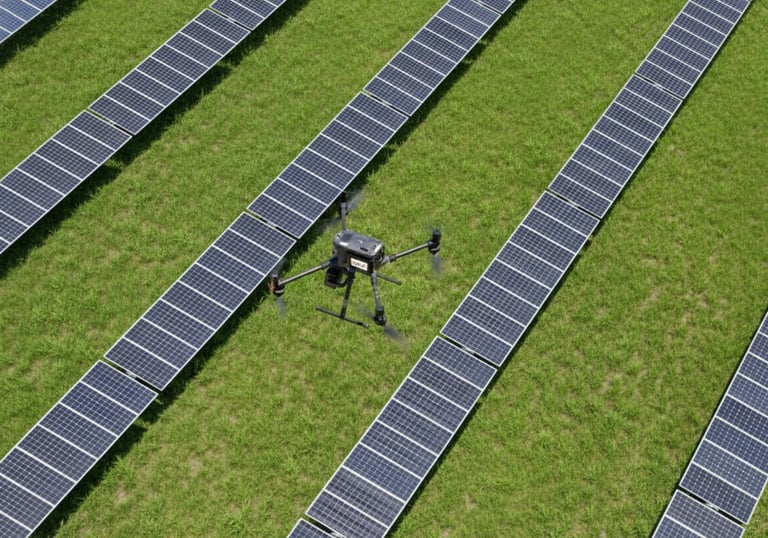
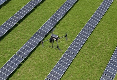
Revisamos infraestructuras y plantas solares con cámaras térmicas avanzadas.

Evaluamos cubiertas, líneas eléctricas y aerogeneradores

Termografía
Technician operating drone equipment inspecting solar panels with thermal camera.

Toporgrafía aérea y Cartografía

Fotogrametría

Inspecciones industriales con drones

Inspección de infraestructuras y vías ferroviarias

Inspección de líneas eléctricas, torres eléctricas y subestaciones

Inspección de centros de transformación

Inspección de aerogeneradores y parques eólicos

Generación de modelos digitales del terreno

Galería

Imágenes que reflejan precisión y tecnología avanzada

Industrial drone flying over a solar farm at sunset with detailed thermal camera visible
3D point cloud model of a complex industrial site with vibrant blue and cyan highlights
High-resolution aerial photogrammetry of a railway infrastructure showing precise topographic details
Close-up of a wind turbine inspection using a drone equipped with lidar scanning technology

Proyectos clave

Soluciones precisas y avanzadas para todo tipo de inspecciones

High-tech drone performing a precise LIDAR scan over industrial terrain with dynamic data visuals
Escaneado LIDAR

Mapeamos con drones para modelos 3D exactos

Drone inspecting a photovoltaic solar farm with thermal imaging cameras at sunset
Inspección Térmica

Detección rápida de fallos en paneles solares

Operator controlling drone near an electrical substation with holographic interface overlay
3D digital terrain model with overlaid infrastructure lines and glowing blue data points
Inspección Industrial

Revisión segura de infraestructuras complejas

Topografía Aérea

Cartografía precisa con drones y fotogrametría

Contáctanos hoy mismo

Estamos listos para ayudarte con tus proyectos de drones y escaneado lidar.

Teléfono

+34 912 345 678

Email

contacto@niplotech.es

Suscripción Premium

Accede a servicios exclusivos y soporte prioritario